top of page
LAND USE, DEVELOPMENT, & ZONING CONSULTATIONS
Click image to enlarge, use arrows to slide to the next image.

Kill Van Kull Maritime & Arts District
These designs represent an initiative to create a special mixed use zoning district on the North Shore.

The proposal envisions changing part of the current, unused waterside district to allow residential uses, work-live spaces, and places of production alongside the existing maritime industrial use.

It incorporates spaces for public art, work/live housing, retail sites, and mass transit alternatives.

This maritime & arts district offers an alternative to the growing neighborhoods along the north and eastern edges of the island.

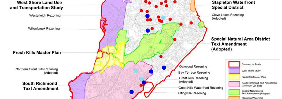
Staten Island Growth Management Task force
In July of 2003, Mayor Michael R. Bloomberg announced the formation of the Staten Island Growth Management Task Force. The Task Force, co-chaired by City Planning Director Amanda M. Burden and Borough President James Molinaro, was charged with examining issues of overbuilding and development, and identifying solutions, potential legislative changes, and strategic long-term planning initiatives to protect and enhance Staten Island's quality of life.

In December 2003, the Task Force released its first recommendations for improving residential development on Staten Island, encouraging appropriate commercial development and identifying long-term planning needs. All three Staten Island community boards, the Borough Board and Borough President overwhelmingly supported the proposed changes. City Planning continued to work with the Task Force and the Department of Buildings (DOB) and proposed a series of zoning text and map amendments to implement additional Task Force recommendations for commercial and residential districts.
Click image to enlarge, use arrows to slide to the next image.

St. George Harbor Commons
The plan for Harbor Commons capitalized on the site’s strongest asset, its location.

The harbor is a destination for Staten Islanders and an entry point for an estimated 2 million tourists annually.

The plan helps reconnect downtown Staten Island to the waterfront, maintains view corridors and offers new vistas of the harbor.

The project goal is to increase the area of commercial activity of the area and define St. George as an attractive gateway for Staten Island.
Click image to enlarge, use arrows to slide to the next image.

Redevelopment Plan for the City of Monessen, PA
The revitalization and urban design plan for the City of Monessen, PA introduces new uses and businesses, preserves historic fabric, and thrusts the under-used riverfront to being a recreational entity.

03.jpg
The City of Monessen had suffered severe environmental contamination because of heavy industrial use; manufacturing was fundamental to the city’s identity since its founding in 1897. The town was blighted and unsafe; moreover, the contamination of the shoreline areas presented a risk of flooding.

The project provides a framework for recovery, revitalization, and incremental redevelopment- all vital to the renewal of local community engagement and investment.
Click image to enlarge, use arrows to slide to the next image.
bottom of page